
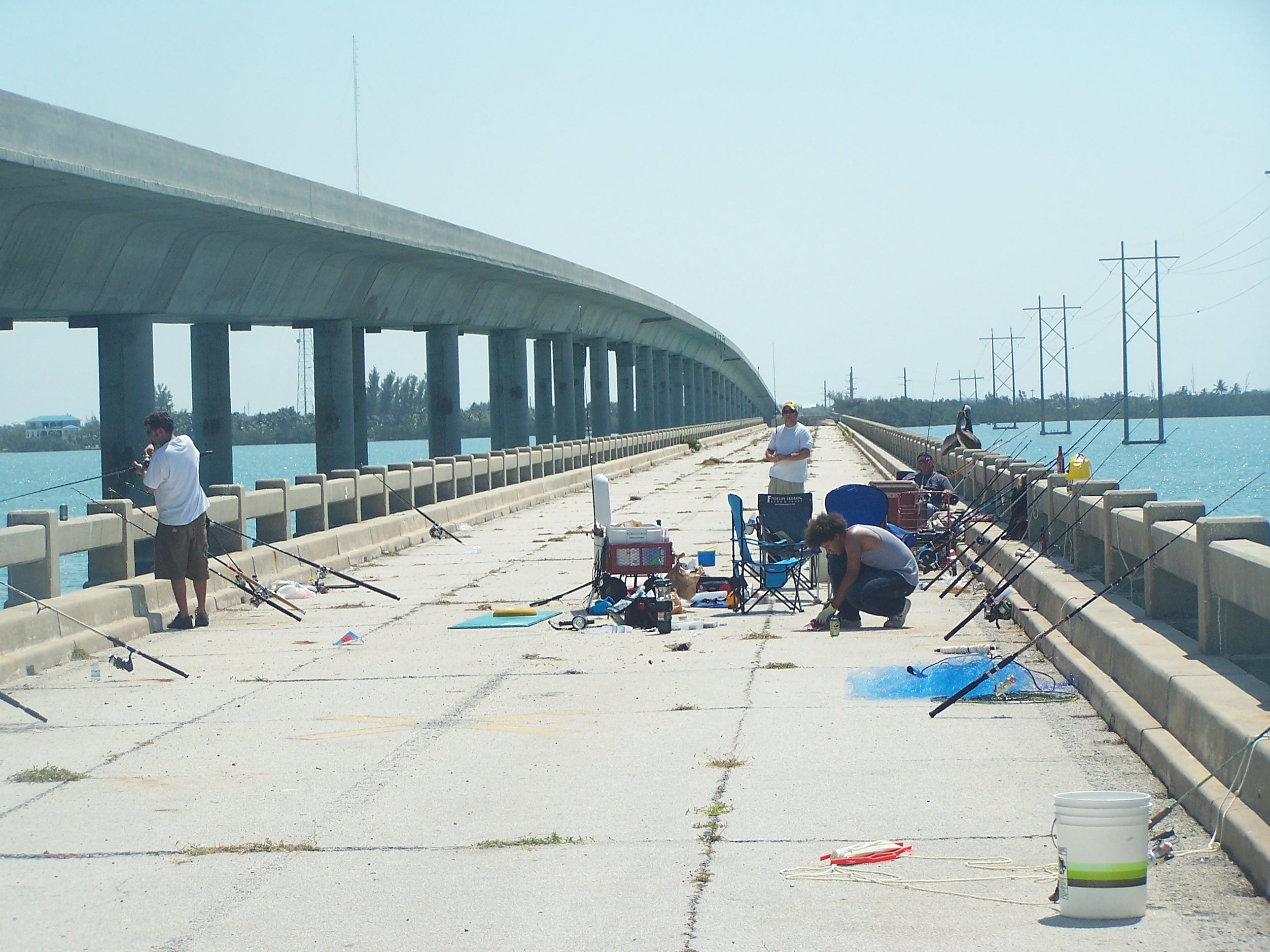
On one of my drives to go fishing in the Dry Tortugas I was making great time and so I took the opportunity to stop at as many bridges as I could to take a photograph for those that have never seen them. Most bridges have parking on the East side and the West side. If you fish the bridges you will know where the Sun rises and sets 🙂 You can expect to catch snappers, mackerels, small groupers and keeper groupers on occasions, yellow jacks, permits, snook, and tarpon can be caught from it and it’s shores. The only difference on the bridges is the depth of water and the fact that some are great for catching certain baits. Also be aware that many of the bridges are also part of the bike trail so please do maintain all your tackle out of the marked bike paths. And most importantly please maintain the bridges garbage free, please use the garbage cans! 🙂


Mile marker 108 Is where this picture adventure starts, just after the county line at a Historic spot named Jewfish Creek. Snook, baby and regular size Tarpon, a few Snappers, Jack Crevales, and trout are a few of the species regularly caught here. The old bridge was demolished and an over passed was finished in early 2000. This did not stop people from coming back to fish in the area.


Now lets look at the other side. This is the ramp that will lead you to the other side.


Some people fishing under the overpass.

Once on the other side parking is not an issue. This is the are known as Gilbert’s Resort.


If you fish on this side beware!


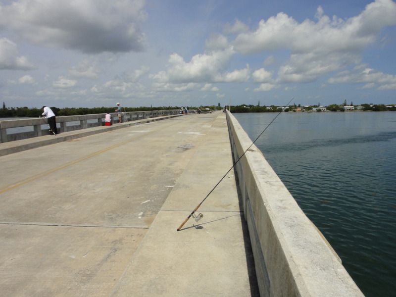
Mile marker 103.6 = Marvin D Adams Waterway Bridge, It is about 15 feet to the water line depending on the tides. You cannot fish from the bridge itself, many people fish from the sides of it. There is parking next to the storage business that is next to it. First check if it is posted as you don’t want to run the risk of getting a ticket. You also need to be careful with boats passing on the waterway. I my self stopped there only once to catch a few pinfish. The people there were getting a few snappers and a couple of sea trout. As in most other bridges in the keys Snook and Tarpon are possible to be caught. This bridge is great to cast for a few sardines in the summer or mullets when these run during the spring.
Below is a picture with a view from under the bridge.

Mile Marker 91.0 = Tavernier Creek Bridge, if careful you can fish from land under the area of the bridge. You can catch pin fish and other baits from this bridge. As far as fish you can catch the common mangrove snappers and at times some groupers. Snook and Tarpon do pass by this bridge as they do on all bridges on the Overseas Highway.


At night be sure to use a flash light or you can fall on the ditch with cut mangrove trees that can end your day of fishing or worst. Just be careful and watch your step on the narrow path.

The kayak ramp access has been moved to face the channel. When I went earlier 2015 they had kayak rentals at the property.
Parking is an issue as you run the risk of being towed.


At Mile Marker 72.8 Channel #2 Bridge a loved bridge by many shore bound fishermen. It is situated on the Gulf side. This bridge has the newly added fishing platforms. White baits such as thread-fin herring can be obtained by dropping a lantern at night or some chum during the morning hours for ballyhoo. Behind Channel #2 is a small beach where you can find mullet (specially during March and April). If you learn how to fish this small bridge you can certainly take home a nice dinner for the family.
Here is the Islamorada sign at Channel #2. On the right you can see Channel #5 bridge from this same area.


Below is the entrance at the West end on Channel #2
A look at the entire Channel #2 fishing bridge (also part of the bike trail).
Below at mile marker 71.4 is Channel #5 bridge. It is situated in the Gulf side. This part of the bridge is a very short piece of the old bridge but you can fish from it. Snappers, mackerels, small grouper, permits, snook, and tarpon can be caught from it and it’s shores.
The East end of Channel #5.
A closer look at it.
A fisherman fishing from the lower area of this bridge’s part.
A look at the cut off from the rest of the brige on the East side, I do not know why they decided to do this.


A look at the shore, you can take your snorkeling gear and adventure into the water to take a closer look at the bridge end that is cut away from the the shore. On the right part of the structure that supports the driving bridge, these are great structures to cast your lines at or to snorkel under or around it.


Here is the West side of Channel #5, one of the favorite bridges to go fishing because of the proximity to the main land and is a frequent stop for many fish that travel from the Gulf side to the Atlantic side. This is another great bridge to drop a lantern and get white baits at night.
In the keys you will always see something out of the ordinary such as this scooter home with pets in it. The owner went out for a run and came back to check on his pets and went for another run again.


Below a closer look at the bridge and fishermen fishing under it


Here is a look at the length of this bridge.
Below at mile marker 65.8 is Long Key Bridge a part of the Long Key State Park, it is situated on the Oceanside. One of the longest fishing bridges along side the 7 mile fishing bridge and twice longer than channel #5 fishing bridge. This bridges holds a little hidden beach, not much frequented because it is covered with seaweed most of the time. But it’s worth checking to see if it is cleared from time to time as it is a fun and shallow place to snorkel. You can catch pinfish along the shores of this bridge and on the first few platforms on the Gulf side of it (platform #3 and 4 are good for catching bait). This is another great fishing bridge!


Below is a picture of the length of this bridge you can almost not see the other end.
Below at mile marker 61.2 is Tom’s Harbor Cut Bridge. Has Fishing Platforms and is known as a good fishing bridge for mangrove snappers. You can catch many other species of fish as well. 😉


Below at mile marker 60.6 is Tom’s Harbor Channel Bridge. It is situated towards the Oceanside but separated by Islands. This is another known good fishing bridge for mangrove snappers in the Florida Keys. So many species of fish pass by this small bridge is incredible. It is a hit or miss bridge but when it is a hit it is a major hit. It has plenty of rocky bottom holding many species of eels. If you fish against the current be prepared to loose many fishing rigs.


A view at the parking lot.

Below at mile marker 53.1 is Vaca Cut Bridge. Here you cannot fish from the bridge but you can fish under the bridge. It is also a great place to have clean chance at catching and releasing a Tarpon. Snapper fishing is good and big jack crevales frequent this area as well.

A look at the bridge and the areas under it.


Below at mile marker 40.0 is the West end of the Seven Mile Bridge. This is a great fishing bridge, if any fish travels from the Gulfside to the Atlantic side of the keys it can be caught here. You can also lower a lantern or bait light at night to catch white bait like sardines and threadfin herring, ballyhoo frequent this bridge, and pinfish can be caught in the grassy areas of the bridge, just lower a chum block and use sabikis tipped with squid to catch them.


It is a bit of a walk to get to the bridge.

A look at the length of the bride, you can barely see where it ends.

You can also fish from the shores of this bridge and many others. There is a free boatramp on this area and a beach with facilities on the Atlantic side of this area. Very nice beach by the way. 
Below at mile marker 39.5 is the Missouri-Little Duck Channel Bridge. Unfortunately this bridge closed off March 2014– you can’t fish here anymore.


Below at mile marker 39.0 is Ohio-Missouri Channel Bridge. One of the best fishing bridges but it is currently closed off since March 2014. You can’t fish here anymore. I was also not able to stop since they are doing construction on the driving bridge.

Below at mile marker 38.7 is Ohio- Bahia Honda Channel Bridge. UPDATE—Closed off March 2014–can’t fish here


. 
Below at mile marker 36.0 is Bahia Honda Bridge old railroad camelback bridge. You cannot fish from it anymore but take your camera out for some nice pictures of the old decaying structures.You can actually walk on part of it from the Bahia Honda state park

(edit 2019) at mile marker 33.0 is Spanish Harbor Bridge west end. This bride was recently renovated and is now open from East to West. It is great stop to catch bait and snappers.

At mile marker 30.2 is Big Pine Key traffic stop light; Continue to No Name Pub, if you can find it. Bogie Channel Bridge (Old Wooden Fishing Bridge). No name bridge is here. This bridge is a must if you need lots of pinfish and ballyhoo. For the pinfish simply use a sabiki tipped with squid. For the ballyhoo place a chum block in the water close to the edges by the grassy areas and have a cast net ready (pinfish this way as well). This bridge holds plenty bait and so does snappers, nighttime snapper fishing is better but in the summer months be ready with mosquitoes spray as they sometimes get overwhelming.
Passing Pine Chanel bridge you can see No Name bridge in the background.

Below is No Name bridge (picture from an older fishing report).
Below at 26.6 is South Pine Channel Bridge, west end of bridge, Oceanside. This one is also closed.

At mile marker 26.0 is Niles Channel Bridge, middle. They shut this one down recently. On plans for reconstruction of fishing bridge. You can still fish from lands near by and from the footings of the bridge.
At mile marker 25.5 is East end of Niles bridge, ocean side.They shut this one down recently.On plans for reconstruction of fishing bridge.
I owe you pics on both ends of this awesome but now closed bridge 😦 in the meantime here is a picture from one of my old fishing reports.
Below at mile marker 23.5 is Kemp Channel Bridge, east end of bridge, ocean side.


Below at mile marker 20.2 is Bow Channel Bridge to Sugarloaf Key. Lots of flats on this bridge with small areas in between the mangroves to launch a Kayak.


Below at mile marker 15.8 is Lower Sugarloaf Channel Bridge. This bridge was closed off March 2014 you cannot fish here anymore.


Below at 14.6 is Saddlebunch #2 Bridge. Nice stop to look at and very shallow bridge at low tide..


Below at mile marker 14.3 is Saddlebunch #3 Bridge. Nice stop to look at but I don’t think you can fish it unless you let a kayak down.


… 


Below at mile marker 13.1 is Saddlebunch #4 Bridge. Another shallow water bridge but with some gaps to let you get a bait or two.


Below at mile marker 12.8 is Saddlebunch #5 Bridge and one of the last shallow water and full of mangrove trees bridges.


Below at mile marker 11.4 is Shark Channel Bridge. One more shallow water bridge on the Oceanside but not as shallow under the driving bridge. Take a long 9 foot bridge rod and you will be able to battle a barracuda, tarpon, or other big fish that hunt under this bridge and yes snappers can be caught here as well.


